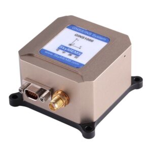
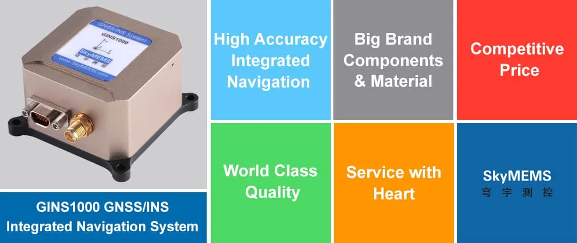
Das integrierte Einzelantennen-Navigationssystem GINS1000 von China Factory verwendet hochpräzise MEMS-Trägheitskomponenten und integriert ein GPS/BD-Satellitennavigationssystem mit einer Frequenz und zwei Modi. Es hat ein eingebautes magnetisches Kursmesssystem und eine Höhenmesslösung. Als chinesischer Hersteller des integrierten GINS1000-Einzelantennen-Navigationssystems verfügen wir über einen speziellen SkyMEMS-Algorithmus für die integrierte Navigation, der eine hochempfindliche Verfolgung und genaue Positionierung im offenen Raum ermöglicht und auch Navigationsanwendungen in der Stadt, im Wald, in Schluchten usw. ermöglicht. Das System zeichnet sich durch geringere Größe, geringeres Gewicht, niedrigere Kosten, geringeren Stromverbrauch, schnellere Inbetriebnahme, höhere Zuverlässigkeit, bessere dynamische Umgebungsanpassung usw. aus. Es kann in den Bereichen taktische Waffen und unbemannte Flugzeuge eingesetzt werden. Es eignet sich für die Navigation und Steuerung aller Arten von sich bewegenden Objekten, wie z. B. unbemannte Luftfahrzeuge (UAVs), Fahrzeugnavigation, Überwasserfahrzeuge, Schiffe und so weiter.
Das integrierte Einzelantennen-Navigationssystem GINS1000 ist ein hochleistungsfähiges integriertes Navigationssystem, das sich durch hohe Zuverlässigkeit und Stabilität bei dynamischen Anwendungen auszeichnet und in den folgenden Bereichen weit verbreitet ist: - Unbemannte Luftfahrzeuge - Schiffe und Boote - Fahrzeugnavigation - Überwasserfahrzeuge - Plattformstabilisierung 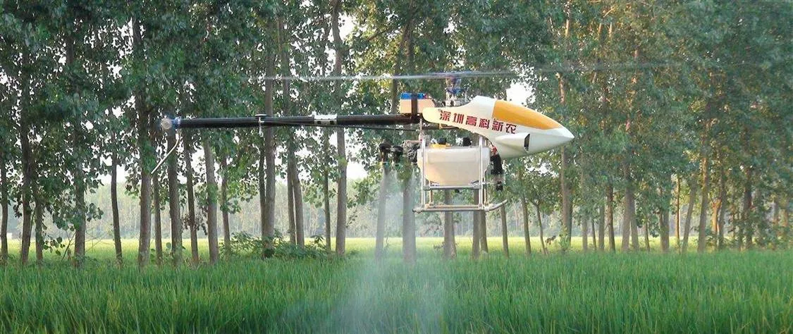
Ein UAV ist ein unbemanntes Luftfahrzeug, gemeinhin auch als Drohne bekannt, ein Luftfahrzeug ohne menschlichen Piloten an Bord. Der Flug von UAVs kann mit verschiedenen Graden von Autonomie erfolgen: entweder unter Fernsteuerung durch einen menschlichen Bediener oder autonom durch Bordcomputer. Das integrierte GNSS/INS-Navigationssystem GINS1000 ist ein kostengünstiges und leistungsstarkes integriertes Navigationssystem, das in der unbemannten UAV-Navigation weit verbreitet ist.

Das integrierte Navigationssystem GINS1000 GNSS/INS ist ein kostengünstiges, leistungsstarkes integriertes Navigationssystem, das in Schiffen und Booten weit verbreitet ist. 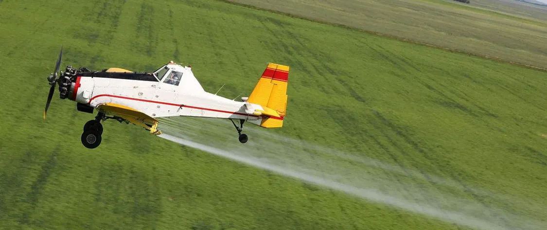
Das integrierte Navigationssystem GINS1000 GNSS/INS ist ein kostengünstiges und leistungsstarkes integriertes Navigationssystem, das in der zivilen Luftfahrt weit verbreitet ist.
Das integrierte Einzelantennen-Navigationssystem GINS1000 wurde von SkyMEMS entwickelt und hergestellt. Es zeichnet sich durch hohe Leistung und Genauigkeit sowie hohe Zuverlässigkeit aus. Es ist ein beliebtes GNSS/INS-System auf dem Markt, das die folgenden Hauptvorteile hat:

China GINS1000 Single Antenna Integrated Navigation System ist ein hochleistungsfähiges integriertes Navigationssystem, das sich durch hervorragende technische Vorteile auszeichnet: - Hochpräzises MEMS-Inertialsystem mit GPS/BD-Dual-Mode-Satellitennavigationssystem - Hohe Genauigkeit: Richtung: 0.15°(rms), Attitude: 0.05° (rms), Geschwindigkeit <0.15m/s, Position < 1.5m - Unterstützt dynamische Schnellausrichtung - Hohe Zuverlässigkeit, starke Vibrations- und Schockresistenz - Mehrere Schnittstellen: RS232/RS422/TTL/CAN - Einfache Integration mit Kilometerzähler/DVL-Sensor GINS1000 GNSS/INS Integriertes Navigationssystem verwendet große Markenkomponenten, fortschrittliche Produktionsverfahren, vollständig kalibriert, fortschrittlicher SkyMEMS-Algorithmus, der sicherstellt, dass unsere Produkte tatsächlich präzise und perfekte Leistung haben. 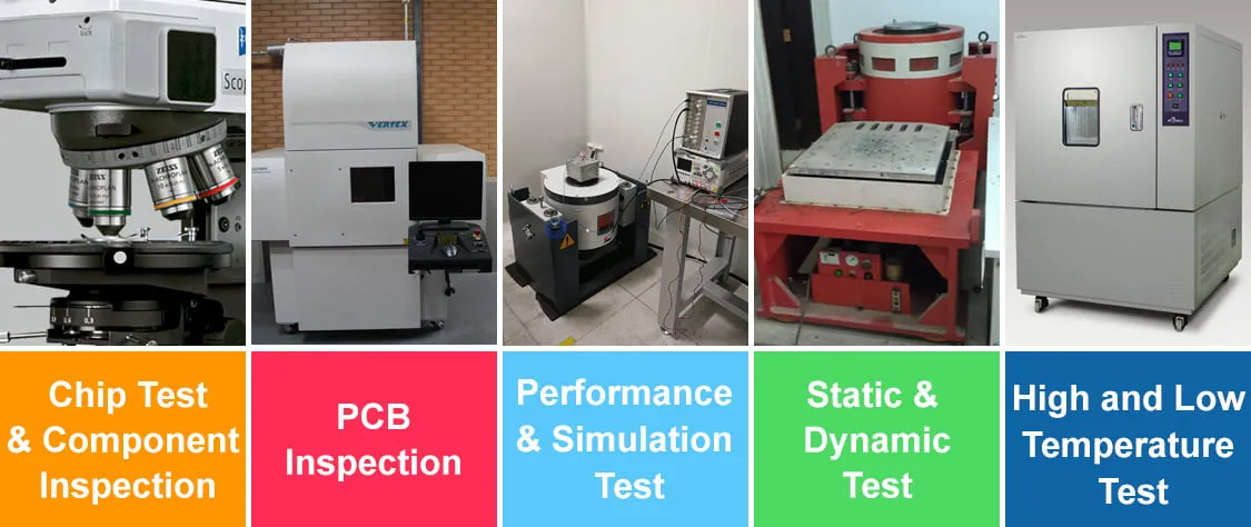
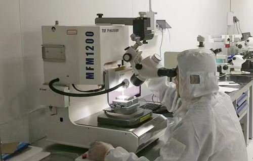
Wir verfügen über ein fortschrittliches Produkttestteam und Messgeräte, und wir betrachten die Qualität als das Leben des Unternehmens. Alle unsere Produkte müssen die strengsten Qualitätskontrollverfahren durchlaufen, und unsere einzigartige 12-stufige Qualitätskontrolle gewährleistet, dass unsere Produkte ein hohes Qualitätsniveau haben. 
Dank strenger Kostenkontrolle und massiver Produktion können wir die wettbewerbsfähigsten und kostengünstigsten Preise anbieten. Außerdem verfügen wir über umfangreiche Erfahrungen im ODM-Service für Kunden in aller Welt, so dass wir eine langfristige Win-Win-Zusammenarbeit mit unseren Kunden aufbauen können. 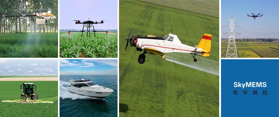
Wir konzentrieren uns kontinuierlich auf MEMS Mess- und Steuerungstechnologien und haben das fortschrittlichste integrierte Navigationssystem mit einer Antenne in China, das GINS1000, entwickelt. Das GINS1000 wird weithin in unbemannten Luftfahrzeugen, Schiffen und Booten, Fahrzeugnavigation, Überwasserfahrzeugen, zivilen Flugzeugen usw. eingesetzt, und mehr als 300 Kunden nutzen unser integriertes GNSS/INS-Navigationssystem auf der ganzen Welt. 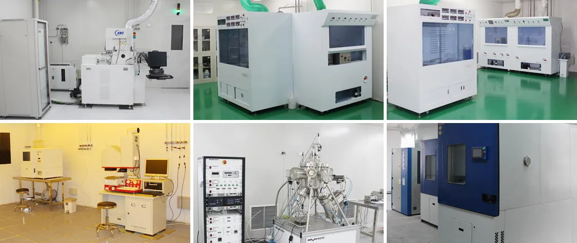
Wir verfügen über eine Produktionslinie von Weltklasse, um sicherzustellen, dass die Produktionsverfahren wissenschaftlich, präzise und normativ sind, was auch eine schnelle Lieferung unserer Produkte gewährleistet. 
Wir verfügen über ein professionelles Team von Technikern, das 24 Stunden am Tag technischen Support und einen ausgezeichneten Kundendienst bieten kann. Kunden mit Herz zu dienen ist das Prinzip von SkyMEMS, die Kundennachfrage ist die grundlegende treibende Kraft unserer Entwicklung. Wir behandeln unsere Kunden mit Herz, die Zufriedenheit der Kunden ist die Richtung und das Ziel von SkyMEMS. Durch kontinuierliche technologische Innovation und Serviceverbesserung werden wir eine Win-Win-Zusammenarbeit mit unseren Kunden realisieren.
F: Was ist ein integriertes GNSS/INS-Navigationssystem?
A: Global Navigation Satellite System (GNSS)-Empfänger liefern Positionskoordinaten und den Geschwindigkeitsvektor mit Datenraten von 1 - 10 Hz. Allerdings benötigen sie Daten von mindestens 4 GNSS-Satelliten, was z.B. in den Straßenschluchten der Großstädte oft nicht der Fall ist. Navigationssysteme basieren auf Beschleunigungsmessern und Gyroskopen, so genannte Inertialnavigationssysteme (INS), die Position, Geschwindigkeit und Lage mit Datenraten von typischerweise 1 kHz liefern. Damit sind sie die primären Sensoren für das Leit-, Navigations- und Kontrollsystem (GN&C) von Flugzeugen, Raketen und Satelliten. Sie arbeiten ohne externe Hilfsinformationen. Aufgrund der inhärenten Fehler der Trägheitssensoren wächst der Positionsfehler eines INS jedoch mit der Zeit unbegrenzt an. Die Fusion beider Systeme mit Hilfe eines Kalman-Schätzers nutzt die Vorteile dieser komplementären Sensoren und führt zu einem gleichmäßigen Datenstrom von Position, Geschwindigkeit und Lage mit hoher Datenrate und nun mit begrenzten Fehlern. Darüber hinaus ist ein solches integriertes Navigationssystem in der Lage, die Fehler der Trägheitssensoren im Flug zu kalibrieren. Eine enge Kopplung der Pseudoranges und Deltaranges des GNSS-Empfängers mit den INS-Daten liefert zuverlässige Positionskoordinaten, selbst wenn weniger als 4 GNSS-Satelliten sichtbar sind. Durch eine tiefe GNSS/INS-Integration, bei der die Nachführschleifen des GNSS-Empfängers mit den INS-Daten gekoppelt werden, ist es in einem weiteren Schritt möglich, auch solche Satelliten zu verfolgen, die für einige Zeit nicht sichtbar sind, was eine sofortige Wiederherstellung verlorener Satellitensignale ermöglicht.
F: Wie sieht es mit den Lieferzeiten aus?
A: für unser Standardmodell, wenn wir sie auf Lager haben, brauchen nur 2 ~ 3 Tage, um vor dem Versand erneut zu testen, wenn es nicht auf Lager ist, dann brauchen etwa 3 Wochen, um die Produktion und Tests zu arrangieren. Für die ODM elektronisches Produkt, wenn die Struktur zu ändern, wird es rund 4 ~ 5 Wochen benötigen, um die Produktion und Tests zu arrangieren.
F: Wie kann ich die Zahlung veranlassen?
A: über die Zahlung, zahlen Sie bitte auf unser Firmenkonto, der Name des Begünstigten: NANJING SKY MEMS TECHNOLOGY CO., LTD. Und unsere E-Mail ist nur @skymems.com, um mit u formell zu kontaktieren. Um dies zu beachten, um den Verlust zu vermeiden.