


Quick Answer
The most accurate GNSS/INS systems combine multi-frequency, multi-constellation GNSS receivers with high-performance inertial sensors, such as fibre optic gyroscopes (FOGs) or ring laser gyroscopes (RLGs), as well as advanced sensor fusion algorithms.
According to Paul D. Groves’ Principles of GNSS, Inertial, and Multisensor Integrated Navigation Systems (2nd edition), the NovAtel application notes on GNSS/INS integration and the International Committee on Global Navigation Satellite Systems (ICG) state that tightly coupled GNSS-INS architectures generally provide superior positioning accuracy, continuity, and reliability, particularly in environments where satellite signals are partially blocked or temporarily unavailable.
Introduction
High-precision positioning is now essential in many different industries, including autonomous driving, precision agriculture, aerial surveying, robotics, offshore engineering, and defence. Although Global Navigation Satellite Systems (GNSS) provide accurate positioning globally under open-sky conditions, their performance can deteriorate significantly in urban canyons, tunnels, forests, or other environments where satellite visibility is limited.
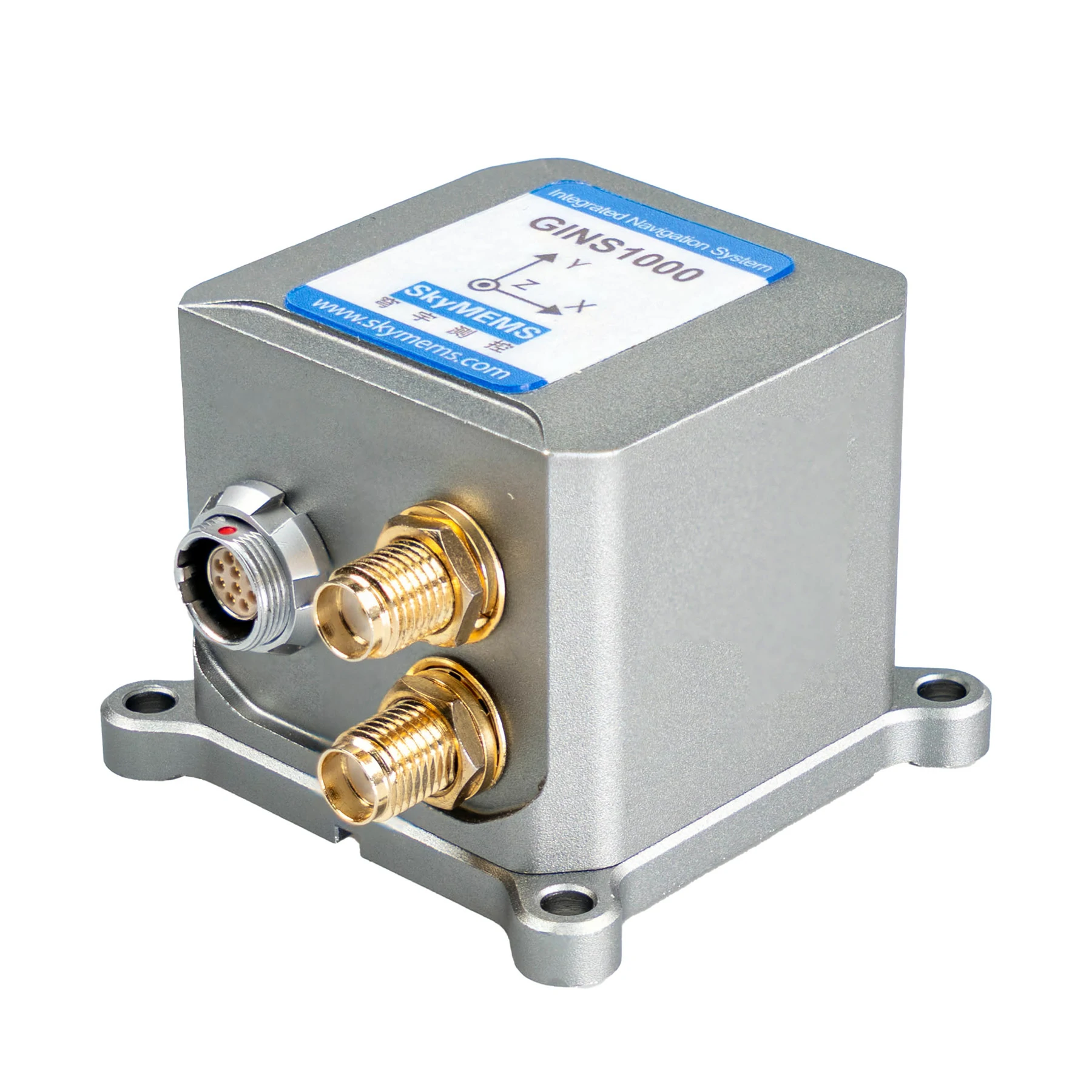
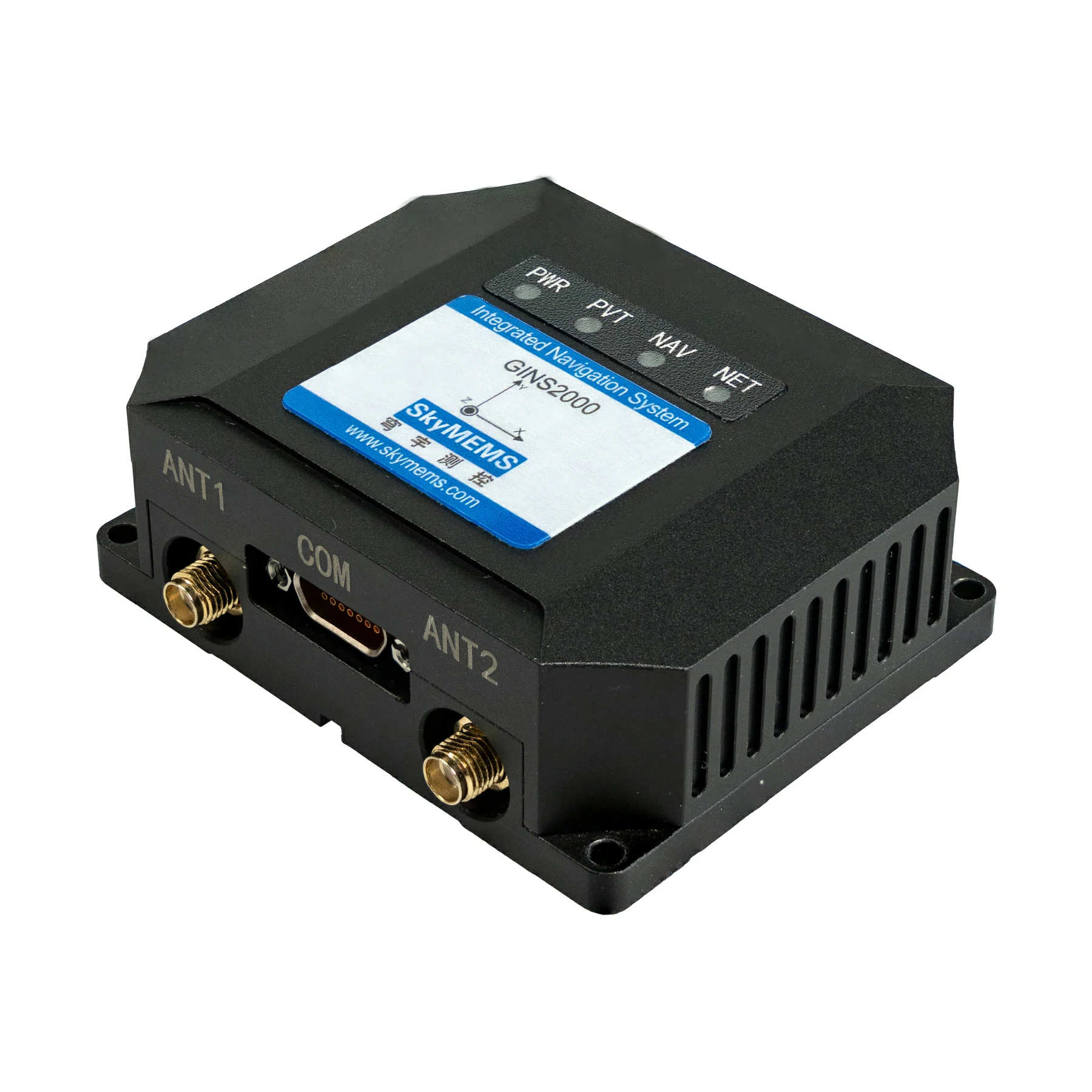
To overcome these limitations, engineers are increasingly turning to GNSS INS technology, which combines satellite navigation with an Inertial Navigation System (INS). By combining the complementary strengths of both technologies, integrated navigation systems can deliver continuous position, velocity, and attitude information, even during temporary GNSS outages.
However, not all integrated navigation systems deliver the same level of accuracy. The final positioning result is influenced by sensor quality, receiver performance, fusion algorithms, correction services, and installation methods. Understanding these factors is therefore essential for selecting the most suitable solution for demanding applications.
This article explains what determines GNSS-INS accuracy, compares different system grades, and provides practical guidance on selecting an integrated navigation solution that meets professional performance requirements.
What Is a GNSS INS System?
A GNSS INS system combines two independent navigation technologies to provide a single, integrated solution.
The first component is the Global Navigation Satellite System (GNSS) receiver, which determines geographic position using signals transmitted by satellite constellations, including:
GPS, GLONASS, Galileo, BeiDou, and QZSS.
The second component is the inertial navigation system (INS), which continuously measures motion using:
- Accelerometers;
- Gyroscopes;
- In some systems, magnetometers or odometers.
Unlike GNSS, an INS does not depend on external signals. Instead, it estimates changes in position, velocity, and orientation by measuring acceleration and rotational motion.
When both technologies are integrated through advanced filtering algorithms, they compensate for each other’s limitations. GNSS corrects the long-term drift inherent in inertial sensors, while INS bridges temporary satellite signal interruptions by providing uninterrupted motion estimates.
This complementary relationship makes integrated navigation significantly more reliable than using either technology independently.

What Determines the Accuracy of GNSS INS?
The accuracy of a GNSS INS solution depends on multiple hardware and software factors rather than a single specification. Understanding these variables helps users evaluate products beyond marketing claims.
-
Inertial Sensor Grade
The inertial measurement unit (IMU) is one of the most important contributors to overall navigation performance.
IMUs are commonly classified into several categories:
- Consumer-grade MEMS
- Industrial-grade MEMS
- Tactical-grade MEMS
- Fiber Optic Gyroscope (FOG)
- Ring Laser Gyroscope (RLG)
Higher-grade gyroscopes exhibit lower bias instability and reduced drift, allowing the INS to maintain accurate navigation during GNSS outages for longer periods.
For applications involving autonomous vehicles, airborne mapping, or marine surveying, tactical-grade MEMS or FOG-based systems are typically preferred.
-
GNSS Receiver Performance
Modern receivers differ substantially in their ability to process satellite signals.
High-performance receivers generally support:
- Multi-frequency tracking (L1/L2/L5)
- Multi-constellation reception
- Carrier-phase measurements
- RTK corrections
- PPP services
Tracking multiple constellations simultaneously improves satellite availability, strengthens geometry, and enhances positioning accuracy, particularly in partially obstructed environments.
-
Sensor Fusion Algorithm
The integration algorithm is often as important as the hardware itself.
Most professional systems employ variants of the Extended Kalman Filter (EKF) or other advanced estimation techniques to combine measurements from multiple sensors.
Depending on system design, GNSS and INS can be integrated using:
- Loosely coupled architecture
- Tightly coupled architecture
- Deeply coupled architecture
Tightly coupled systems generally outperform loosely coupled solutions because they continue using partial satellite observations even when fewer than four satellites are visible, improving continuity in challenging environments.
-
Differential Correction Services
Raw satellite positioning is rarely sufficient for applications requiring centimeter-level accuracy.
Professional systems often integrate correction services such as:
- RTK (Real-Time Kinematic)
- Network RTK
- PPP (Precise Point Positioning)
- PPP-RTK
These corrections reduce satellite orbit, clock, and atmospheric errors, dramatically improving absolute positioning performance.
-
Calibration and Installation
Even a high-end navigation system may underperform if installation is poor.
Important considerations include:
- Accurate IMU alignment
- Stable mounting
- Antenna placement
- Lever-arm calibration
- Vibration isolation
Proper installation minimizes systematic errors and allows sensor fusion algorithms to perform as intended.
Comparison of Different GNSS INS System Grades
| System Grade | Typical IMU Technology | Typical Position Accuracy* | Typical Applications |
| Consumer Grade | MEMS | Meter-level | Consumer drones, navigation devices |
| Industrial Grade | High-performance MEMS | Sub-meter to decimeter | Mobile mapping, construction equipment |
| Tactical Grade | Tactical MEMS | Centimeter with RTK | Robotics, autonomous vehicles, UAV mapping |
| Survey Grade | Tactical MEMS + Advanced GNSS | Centimeter | Geospatial surveying, LiDAR mapping |
| Navigation Grade | FOG or RLG | Highest continuity and precision | Aerospace, marine navigation, and defense |
Actual accuracy depends on correction services, satellite visibility, environmental conditions, and system configuration.
Applications That Demand the Highest Accuracy
Not every application requires the same level of navigation performance. Selecting an appropriate GNSS INS system begins with understanding operational requirements.
-
Autonomous Vehicles
Self-driving vehicles operate in dynamic urban environments where buildings, bridges, or tunnels may block satellite signals. High-accuracy integrated navigation enables reliable lane-level positioning while maintaining continuous vehicle localization during temporary GNSS interruptions.
-
UAV Mapping and Photogrammetry
Survey-grade drones require precise position and attitude information to reduce ground control point requirements and improve mapping efficiency. High-performance GNSS INS solutions significantly enhance the geometric accuracy of aerial imagery and LiDAR point clouds.
-
Marine Surveying
Hydrographic surveys, offshore construction, and autonomous surface vessels depend on stable heading and position information despite vessel motion and varying satellite conditions. Integrated navigation systems improve measurement consistency and operational safety.
-
Precision Agriculture
Modern agricultural machinery uses high-accuracy positioning for automated steering, variable-rate application, and repeatable field operations. Combining GNSS with inertial navigation ensures smoother guidance when trees, terrain, or machinery temporarily obstruct satellite reception.
How to Choose the Right GNSS INS System?
Selecting the right GNSS INS solution requires balancing accuracy requirements, environmental conditions, integration complexity, and project budget. While premium navigation-grade systems deliver exceptional performance, they are not always necessary for every application. The most effective approach is to evaluate the complete operational scenario rather than focusing on a single accuracy specification.
-
Define Your Accuracy Requirements
The first step is determining the level of positioning precision your application actually requires.
For example:
Consumer navigation typically requires meter-level accuracy.
Construction equipment and machine control often benefit from decimeter-level positioning.
UAV photogrammetry and mobile mapping generally require centimeter-level accuracy.
Autonomous vehicles, hydrographic surveys, and defense applications demand both centimeter-level positioning and highly accurate attitude information.
Choosing a system with unnecessarily high specifications increases costs without delivering meaningful operational benefits.
-
Evaluate Operating Environments
Environmental conditions significantly affect navigation performance.
Projects conducted in open fields or offshore environments usually maintain stable satellite visibility, allowing GNSS to perform efficiently. In contrast, operations in dense cities, forests, tunnels, mines, or under bridges frequently experience signal blockage or multipath interference.
For these challenging environments, systems featuring tightly coupled integration, high-quality IMUs, and robust sensor fusion algorithms provide greater reliability because they can maintain accurate navigation during temporary GNSS interruptions.
-
Consider Correction Services
Correction services are essential for applications requiring survey-grade positioning.
Common options include:
- RTK (Real-Time Kinematic)
- Network RTK
- PPP (Precise Point Positioning)
- PPP-RTK
RTK typically provides centimeter-level positioning with minimal latency when a correction network or local base station is available. PPP solutions are more suitable for large-scale operations where local infrastructure is unavailable, although initialization times may be longer.
-
Assess System Integration
Modern navigation systems rarely operate independently.
Many professional applications integrate GNSS INS with additional sensors, including:
- LiDAR
- Cameras
- Wheel encoders
- Radar
- Odometers
Compatibility with existing software, communication protocols, and data formats should therefore be considered during system selection.
Common Sources of Positioning Error
Even advanced integrated navigation systems are affected by various error sources. Understanding these limitations helps users optimize system performance and interpret positioning results more accurately.
-
Satellite Signal Blockage
Buildings, trees, cliffs, tunnels, and other obstacles can interrupt satellite visibility, reducing the number of available satellites and weakening positioning accuracy.
-
Multipath Effects
GNSS signals reflected from nearby structures may reach the receiver along multiple paths, introducing measurement errors that reduce positioning precision.
-
IMU Drift
All inertial sensors accumulate small measurement errors over time. Although GNSS continuously corrects these errors during normal operation, drift increases whenever satellite updates become unavailable.
-
Calibration Errors
Incorrect alignment between the GNSS antenna and IMU can introduce systematic positioning and attitude errors. Careful installation and calibration are therefore essential for achieving optimal performance.
-
Environmental Influences
Extreme temperatures, mechanical vibration, electromagnetic interference, and rapid vehicle dynamics may affect sensor performance if the system is not properly designed or installed.
GNSS INS Selection Guide
| Application | Recommended IMU Grade | GNSS Configuration | Suggested Accuracy |
| Consumer Navigation | Consumer MEMS | Single or Multi-Constellation | Meter-level |
| Precision Agriculture | Industrial MEMS | Multi-Frequency + RTK | 2–5 cm |
| UAV Surveying | Tactical MEMS | Multi-Frequency + RTK/PPK | 1–3 cm |
| Mobile Mapping | Tactical MEMS | Multi-Frequency + RTK | Centimeter-level |
| Autonomous Vehicles | Tactical MEMS / FOG | Tightly Coupled + RTK | Centimeter-level with continuous attitude |
| Marine Survey & Defense | FOG / RLG | Multi-Frequency + PPP or RTK | Highest available precision |
Future Trends in GNSS INS Technology
As positioning requirements become more demanding across transportation, robotics, surveying, and intelligent infrastructure, integrated navigation technology continues to evolve rapidly.
A significant trend is the adoption of multi-frequency, multi-constellation GNSS receivers, which can track signals from GPS, Galileo, GLONASS, BeiDou, and regional satellite systems simultaneously. Improved satellite availability enhances positioning reliability, particularly in challenging environments.
Artificial intelligence is also beginning to influence navigation systems. Machine learning algorithms are being explored for adaptive sensor fusion, error prediction, and anomaly detection, thus complementing traditional Kalman filtering techniques.
At the hardware level, advances in MEMS manufacturing are reducing sensor noise and bias instability, while also lowering power consumption and production costs. As tactical-grade MEMS technology matures, more industries will have access to the same level of navigation performance that was previously only achievable with significantly more expensive FOG-based systems.
Cloud-based correction services, real-time PPP, and integrated 5G communications are also expected to improve positioning availability, reducing dependence on local reference stations and enabling high-accuracy navigation on a global scale.
Frequently Asked Questions (FAQ)
- What is the most accurate GNSS INS system?
The most accurate systems typically combine multi-frequency GNSS receivers, tactical-grade MEMS or FOG/RLG inertial sensors, tightly coupled integration, and RTK or PPP correction services to achieve centimeter-level positioning with highly accurate attitude estimation.
- Is GNSS INS more accurate than GNSS alone?
Yes. Integrated navigation improves positioning continuity, attitude estimation, and overall reliability by allowing the inertial system to bridge temporary GNSS signal interruptions while GNSS continuously corrects inertial drift.
- What is the difference between loosely coupled and tightly coupled GNSS INS?
Loosely coupled systems combine completed GNSS position solutions with INS data, while tightly coupled systems integrate raw satellite observations directly with inertial measurements. Tightly coupled architectures generally provide better performance in environments with limited satellite visibility.
- Does every GNSS INS system support RTK?
No. RTK capability depends on both the GNSS receiver hardware and the system’s software architecture. Users should verify compatibility with correction services before selecting a solution.
- Which industries benefit most from GNSS INS technology?
Major applications include autonomous driving, UAV mapping, mobile mapping, precision agriculture, marine surveying, construction machinery, robotics, mining, railway inspection, and defense navigation.
- How can positioning accuracy be improved?
Accuracy can be improved by selecting a high-quality IMU, using multi-frequency GNSS receivers, enabling RTK or PPP corrections, performing proper installation and calibration, and maintaining good satellite visibility whenever possible.
Conclusion
No single GNSS INS system is universally the most accurate for every application. Instead, navigation performance depends on the combined capabilities of inertial sensors, the GNSS receiver, correction services, sensor fusion algorithms, and installation quality. Systems incorporating multi-frequency, multi-constellation GNSS receivers; tactical-grade MEMS or FOG/RLG IMUs; tightly coupled integration; and RTK or PPP corrections consistently deliver the highest levels of positioning accuracy and reliability.
For organisations investing in autonomous systems, precision surveying, mobile mapping, or industrial automation, it is more valuable to select a solution based on real operational requirements than to compare specifications alone. Understanding the factors that influence accuracy and choosing an integrated navigation system that is tailored to the application environment enables users to achieve dependable positioning performance, thereby improving operational efficiency, safety, and long-term project outcomes.